FishHardDave
-
Posts
60 -
Joined
-
Last visited
Content Type
Profiles
Forums
Events
Gallery
Store
Posts posted by FishHardDave
-
-
5 hours ago, muskiedreams said:
What are things like in the SLR with the border lock down? Have they been strict about the border line?
I have heard that they are being very strict in the Niagara River. I understand that fishing is not allowed across the border (either direction) even with a fishing license and passport or enhanced driver's license. I,m not sure but I think they are allowing boaters to cross the line if it is needed to navigate safely between points. But there could be an issue if you stop on the other side of the line or maybe even drift or slightly cross while fishing. I would think that in some areas in the islands, it might be even more of a headache.
They are enforcing the border shutdown. Saw the border patrol on the US side and Canadian side but I was no where near the border so they didn't bother me. My understanding is the within a certain distance of the border it is considered international waters so if you are strictly travel through, I don't believe that it is an issue but if you are fishing on the wrong side then you'll get a visit!
-
7 hours ago, Doug N said:
Thank you Dave. Guess I'm tech dumb, cant figure out how to get this on my laptop, Android phone or tablet.
If you have an Android phone or tablet just go to the Google Play store and search for Navionics Boating. It is not something that you can get on your laptop! You can look at the Navionics charts on the Free Chart Viewer on the Navionics website but the new layers aren't there!
-
1 hour ago, Doug N said:
Where can I find the app?
If you have an i-Phone at the Apple App Store or if you have an Android then the Google Play Store!
-
On 7/20/2020 at 10:20 PM, jlrjoz said:
I downloaded this app and didn’t realize it was an overlay option. 15$ /year looks like I may keep this on my phone
Best value in fishing/boating out there! Your app is sharable across all your device as well so if you have a tablet, you can do a lot of planning at home! And it works across different platforms as well e.g. if you have a Samsung Android phone and an Apple i-Pad.
-
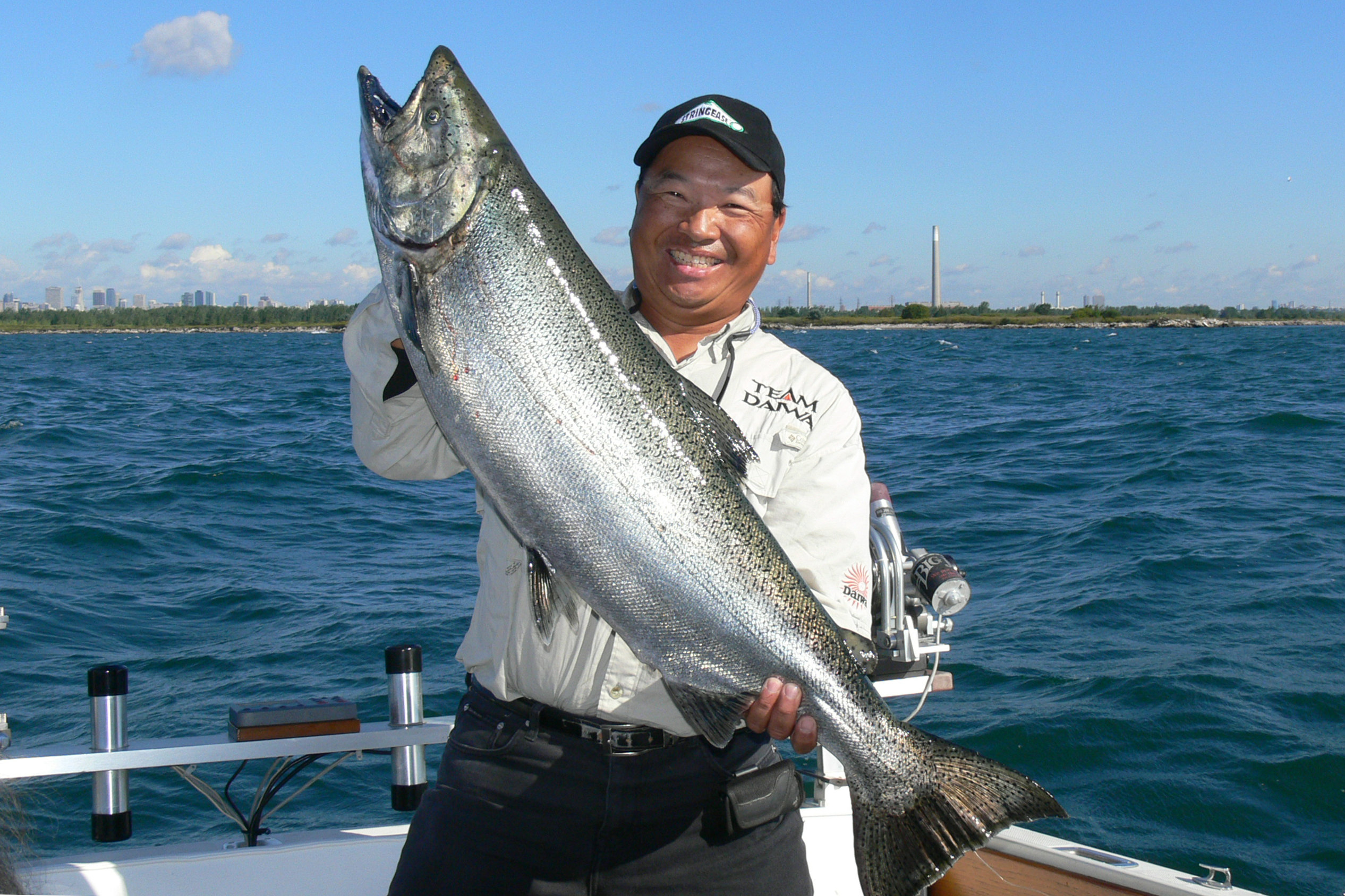
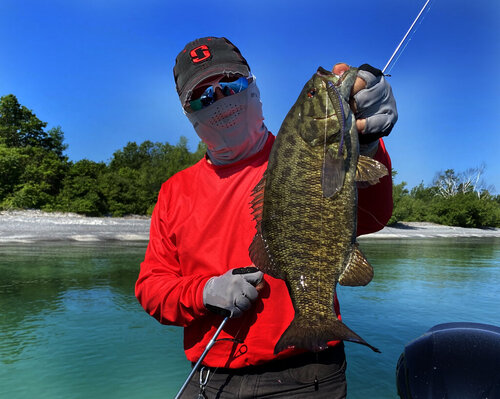
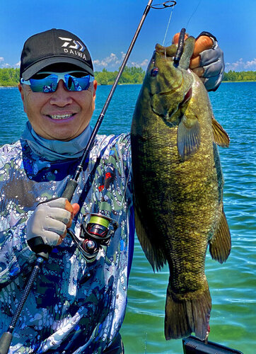
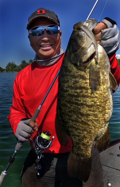
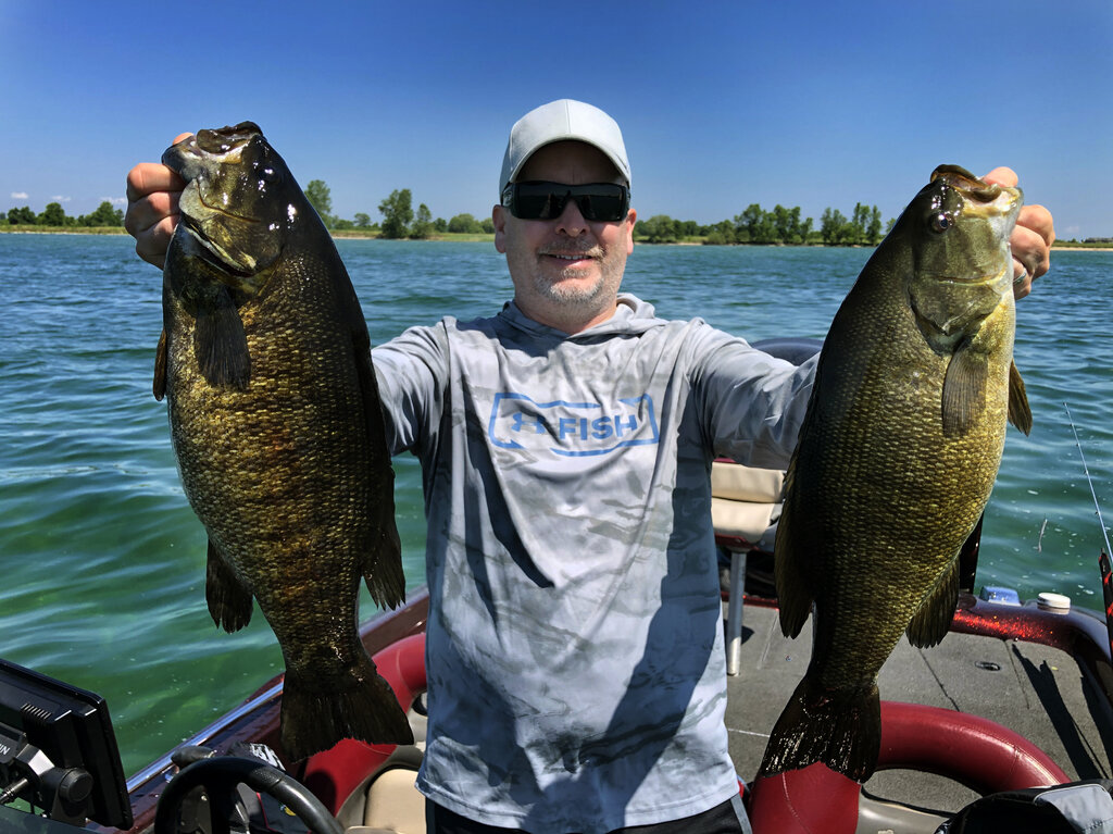
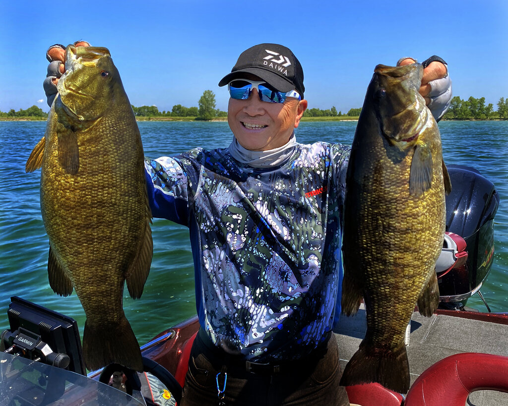
Weather was beautiful for the FMZ20 bass opener! Great to see with the weather that we've been having that a lot of the Smallies have done there thing already. Obviously there are still some bedding fish, but I do believe that most of them are done. They must still be in a bit in a bit of a post spawn funk as we were unable to catch anything of note on a horizontal presentation, one day the drop shot was the deal and the next day it was the Ned rig. It was a blast and we look forward to getting back out again soon.


-
1 hour ago, Prof T said:
Dave, which one's which, top to bottom?
Thanks, Prof T
Nautical Charts
SonarCharts
SonarCharts with Shaded Fishing Ranges
SonarCharts Shading with Satellite Imagery
Relief Shading
Hope that this helps!
-
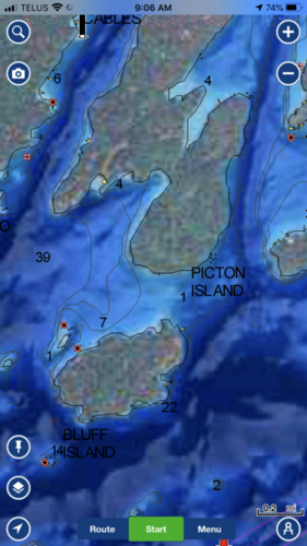
Hey you River Rats who know the St. Lawrence River real well. What are thoughts on the new layer, Hi-Res Relief Shading from Navionics. They're available from the Garmin g3 Ultra charts as well! For full details - https://bit.ly/3d9JMhc


-
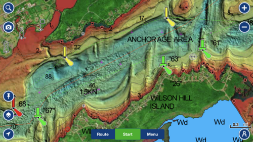
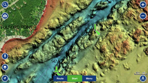
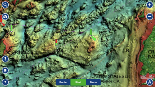
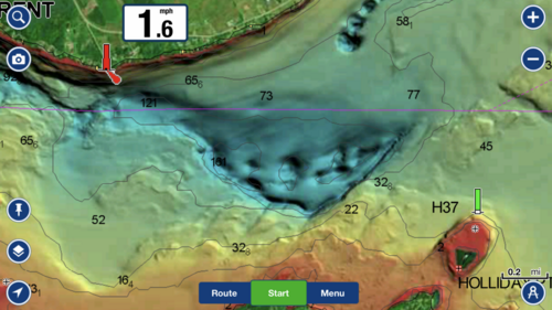
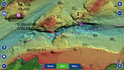
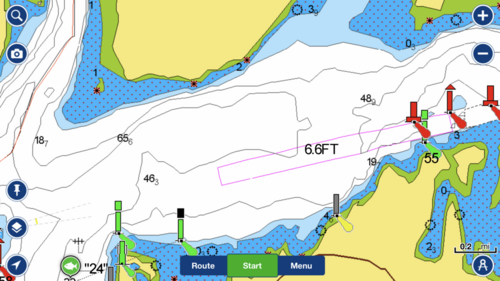
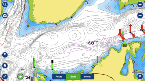
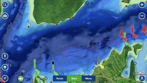
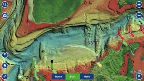
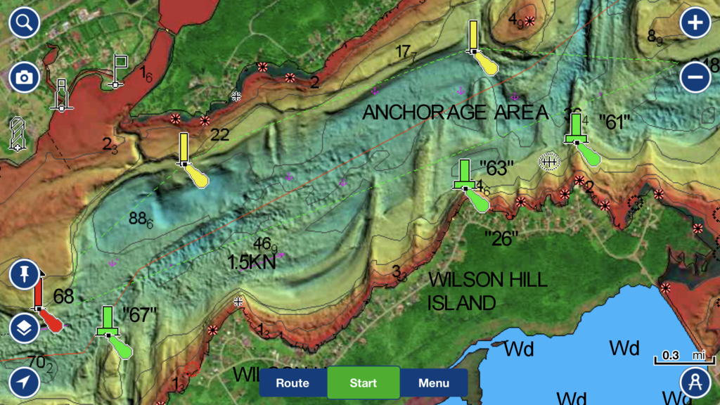
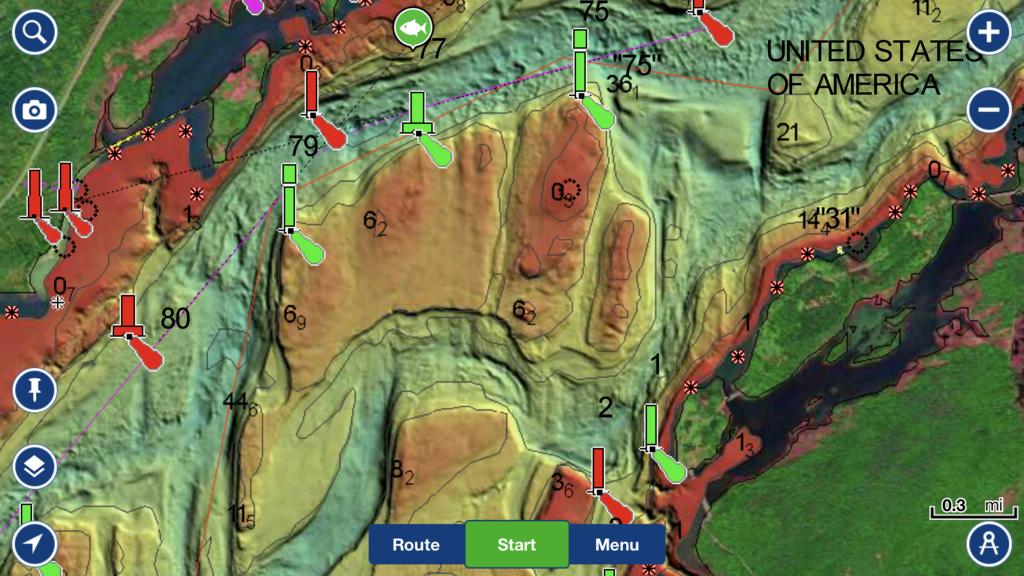
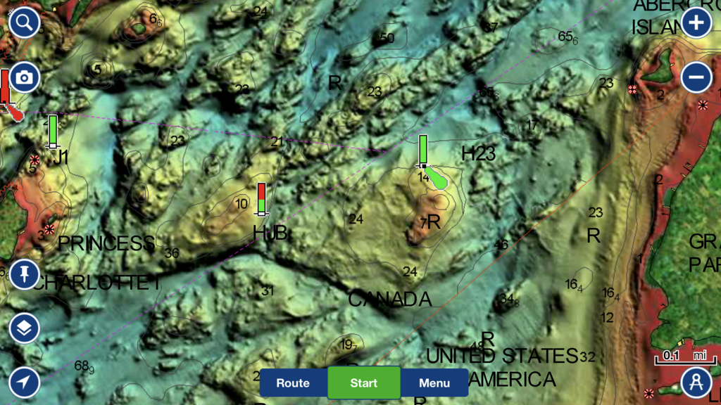
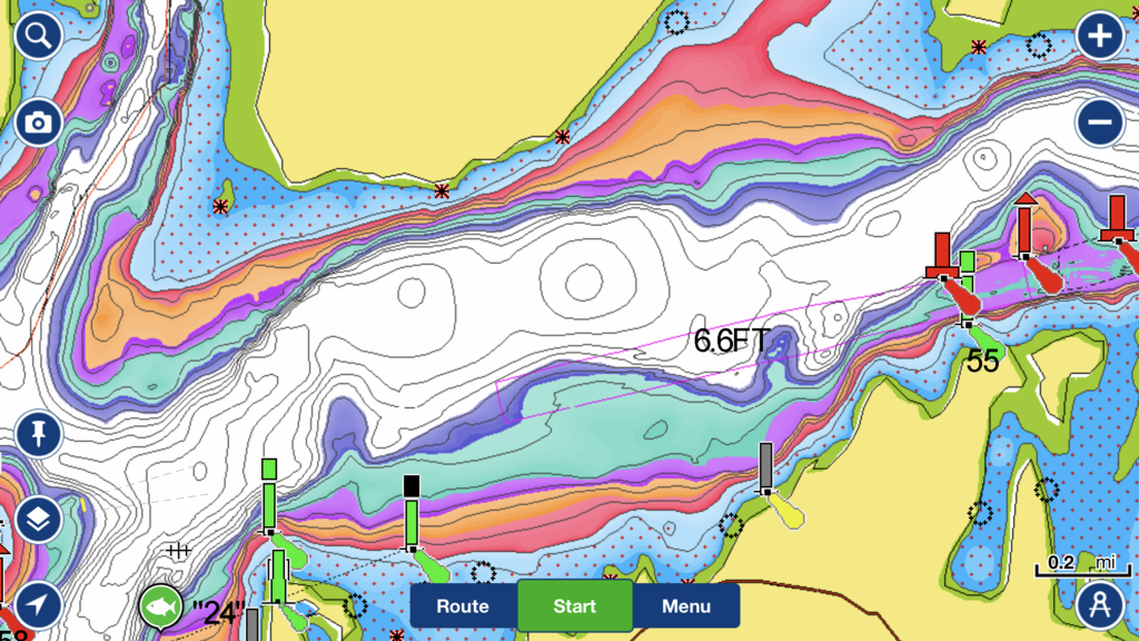
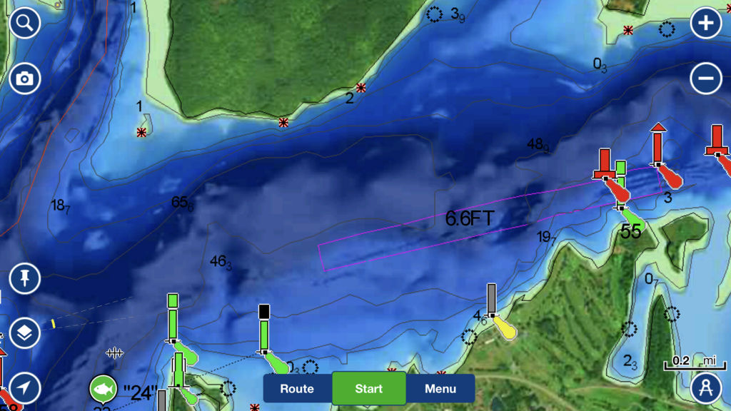
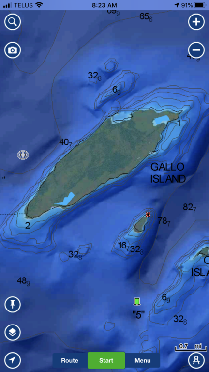
Navionics has just released some updated SonarChart Shading with Satellite Imaging which features more off shore coverage and enhanced satellite imagery. They've also released a layer, Hi-Res Relief Shading for the Navionics Boating, Platinum+ & HotMaps Platinum charts. This new layer is amazing but current only has the St. Lawrence River up this way, I'm sure more is to come. In these images, you see the Nautical Chart, SonarCharts, SonarCharts with colored fishing ranges, SonarChartShading and finally the latest & greatest Hi-Res Relief Shading of the same area on the St. Lawrence River. You do need a current subscription on your Boating App to access this layer. You can visit the Navionics site for full details - https://bit.ly/3d9JMhc Which view do you prefer? #HiResReliefShading #SonarChartsShading #NavionicsBoatingApp #NavionicsPro

-
2 hours ago, Rookie Fisherman said:
Great chart!
-
Up here, we've been told that the border currently is closed both on land and on the water but on Lakes Erie & St. Clair many are still crossing to take advantage of the early bass season state-side. some have been turned back but many have not encountered any issues. Still don't think that it is worth because at some point they will make an example of someone!
-
Up here, we've been told the border is closed both on land and on the water! There are plenty of Canadian anglers who have venture into NY waters on Lake Erie to take advantage of the open early bass season there! Some have been escorted back but many have not, so I think it's kinda luck of the draw. Still not worth it in my mind, there are plenty of fish on both sides of the border, although my NY license is pretty much a waste right now LOL!
-
Totally agree! I've been opposed to early season events held on Lake Ontario, the St. Lawrence and Lake St. Francis for quite a while now! Trust me there are tournament anglers who care!
-
It really depends on what type of fishing that you're doing, I have had both PanOptix & PanOptix LiveScope on my Skeeters and have used it on the ice as well. The real-time scanning is awesome and the imagery on the LiveScope can be mind blowing at time. It is a great tool to locate fish and see what kind of mood that they are in. Lots of positives as for negatives, I think that you have to justify in your mind if it's worth the money for you because they're not cheap. The other problem that I can see is when people become too fixated on watching it much like some people do with an underwater camera and not fishing enough! LOL
-
According to the authorities up the border is currently closed both on land and on the water! On Lakes Erie & St. Clair, Canadians have been crossing over into the US to take advantage of the open bass season that is there. This past weekend, I had friends who were escorted back to the border by the US Border Patrol. The US Border Patrol officers were very nice about the whole thing but if it keeps happening, that might change!
-
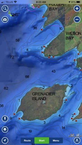
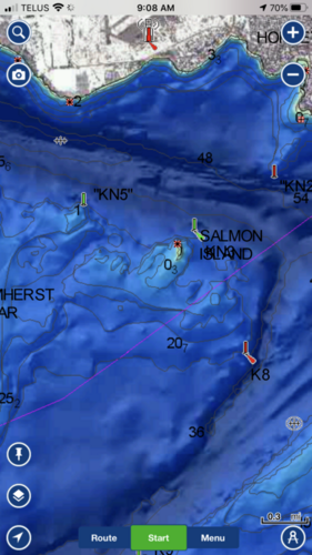
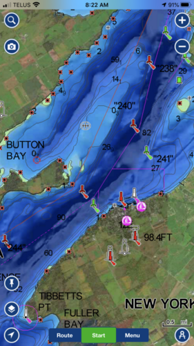
WOW, if you have a current Navionics Boating app subscription, you want to update the app and check out the awesome NEW feature available for your mobile devices at no additional cost.You now have a multiple chart-overlay option that features Navionics Satellite Overlay with SonarChart Shading. See below images off my iPhone of different areas of Lake Ontario & the St. Lawrence Rive! Sonar Charts Shading was previously only available on Navionics Platinum+ & HotMaps Platinum cards! Another great reason to keep your subscription current! Check it out here - https://bit.ly/2KafK15

-
The Smallmouth Bass fishing in the Bateau Channel is not fantastic, so you'll need to venture out into the main river for success! Lots of great guides out that way! Best of luck!
-
Great offer from Navionics! Remember that your new card or renewed subscription with include the best of Navionics and Garmin data! If your card is not yet expired, you can still take advantage of this offer, your new 12 months will start when your current subscription expires.
-
No ice is 100% safe! Condolences to his family & loved ones!
-
Okay, post up and I’ll try to talk you through the process! Also if you can turn on your unit and select “Fishing Map” and check out the details on the map!
-
You can just buy a chip and plug it in! But do you have an older chip or just the maps built-in the unit?
-
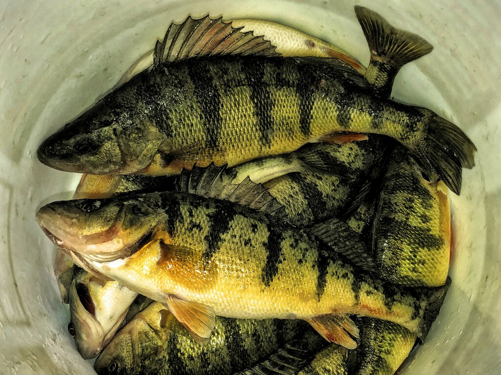
Looks like everyone is finally getting out on the ice! Got out for perch and caught lots but mostly dinks, kept about 20 nice eaters!

-
On 1/20/2019 at 4:35 AM, Fishstix said:
Wallyandre Thanks for the reply. How ever The top of the page says "Navonics a Garmin company" I see where you can trade in for the rebate. But it does not list which Garmin products are compatible with the maps. Am I missing something?
Hey FishStix, the Navionics chips are not compatible with Garmin units! You can get one of the new Garmin LakeVu g3 chip and if you upgrade with your old chip you will get 50% off the new chip. It should be available at the end of Feb. The new Garmin LakeVu g3 same as the new Navionics cards incorporate the best of both Navionics & Garmin data! Make sure that your Garmin unit is updated to the software version!
-
 1
1
-
 1
1
-
-
On 1/17/2019 at 7:05 AM, Fishstix said:
Is anyone running the Garmin Lakevu HD ultra maps in the fingerlakes? Are you happy with it?
I have a Garmin 73 DV It has the lake chip in it that came with the unit. Not much detail and way
off on location. I want to upgrade to something more accurate without buying another mfg unit.
FishStix, first of all, do you have it on the Fishing Map view because that's where you get the 1 foot contours. Also, the new Garmin LakeVu g3 chip incorporates both Navionics & Garmin data so it should be pretty accurate.
-
On 1/22/2019 at 6:50 PM, Fishstix said:
Does anyone run this map on the fingerlakes.I am curious how accurate it is.
The new Garmin LakeVü g3 chip incorporates the best of Navionics & Garmin data so it should be very accurate. I didn't look at the Finger Lakes area but I did compare the lakes up here like Lake Simcoe and they looked awesome! 1 foot contours and of course you can shade up to 10 different depth ranges! I'm excited about using this chip this upcoming season.


Lake Ontario chart for Humminbird
in This Old Boat
Posted
I've always used Navionics cards in my Lowrance & Humminbird units and now the Garmin g3 LakeVu on my Garmins! The latest Navionics chips contained both Navionics & Garmin data!