Jump to content

Braddocks Bay sand bar pics. No water !


Rob

Recommended Posts

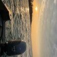
Walked the point of land at the state marina out to the channel markers in the bay.

One pic is looking south into bay. The other pic is looking west towards manitou beach rd homes.

The old channel markers are in about 10 inches water and you can see old trolly line too.

No ice fishing this year!

WATER.jpg

image.jpg

Link to comment
Share on other sites

That is amazing! :o I have been meaning to stop down there and check it out. Had my boat there this spring/summer and had to pull it early. Thanks for sharing those pictures! With only 12-inches of water, do you think the whole bay will have a chance of freezing 100% through this winter?

Link to comment
Share on other sites

It isn't all doom and gloom...occasional periods of low water are necessary for reseeding of the marsh vegetation that supports abundant fish life. A steady water level isn't healthy for the environment. Whether that situation applies here, I don't know. Just trying to make lemonade...

Link to comment
Share on other sites

Wife and I walked out last Monday... wearing only sneakers...

Note the house on the point ..Picture taken looking West

Low_Water_Braddocks_Thanksgiving_2012_018.jpg

same house as first pic.... we were almost to the channel markers

Low_Water_Braddocks_Thanksgiving_2012_027.jpg

In spring 2011, the water was up to the white rub rail on the dock...

Low_Water_Braddocks_Thanksgiving_2012_009.jpg

"welcome to Braddocks Bay car top boat launch"..

Low_Water_Braddocks_Thanksgiving_2012_005.jpg

A few more.......

Low_Water_Braddocks_Thanksgiving_2012_029.jpg

Low_Water_Braddocks_Thanksgiving_2012_010.jpg

Link to comment
Share on other sites

Create an account or sign in to comment

You need to be a member in order to leave a comment

Create an account

Sign up for a new account in our community. It's easy!

Register a new account

Sign in

Already have an account? Sign in here.

Sign In Now
×
×
  • Create New...