



Denoyer
-
Posts
2 -
Joined
-
Last visited
Denoyer's Achievements
0
Reputation
-
Hey guys, I built a free map that covers all five Great Lakes and lets you check: Water temperatures at different depths Thermocline depth across the lake Underwater currents, including speed and direction at different depths Upwelling and downwelling detection Wave heights and forecasts The maps use NOAA data; none of the data is made up, and you can explore everything right from your phone or computer. I originally made this tool for myself and have been using it pretty consistently throughout last season, and it was very helpful. I figured I should make it public so everyone can benefit from it. Check it out here: https://greatlakestrolling.com/ Let me know if you find any issues or have any features you want added; I will definitely add any requested features.
-
Brown Trout HOT Spots.
Denoyer replied to johny d's topic in Questions About Trout & Salmon Trolling?
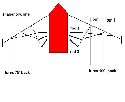 Does anyone have this pdf anymore?