LongLine
-
Posts
4,171 -
Joined
-
Last visited
Content Type
Profiles
Forums
Events
Gallery
Store
Everything posted by LongLine
-
Stagging Yet?
LongLine replied to Striped Bastard's topic in New York Fishing Reports - Lake Ontario (South Shore)
 A plug very similar to a J-plug.
 -
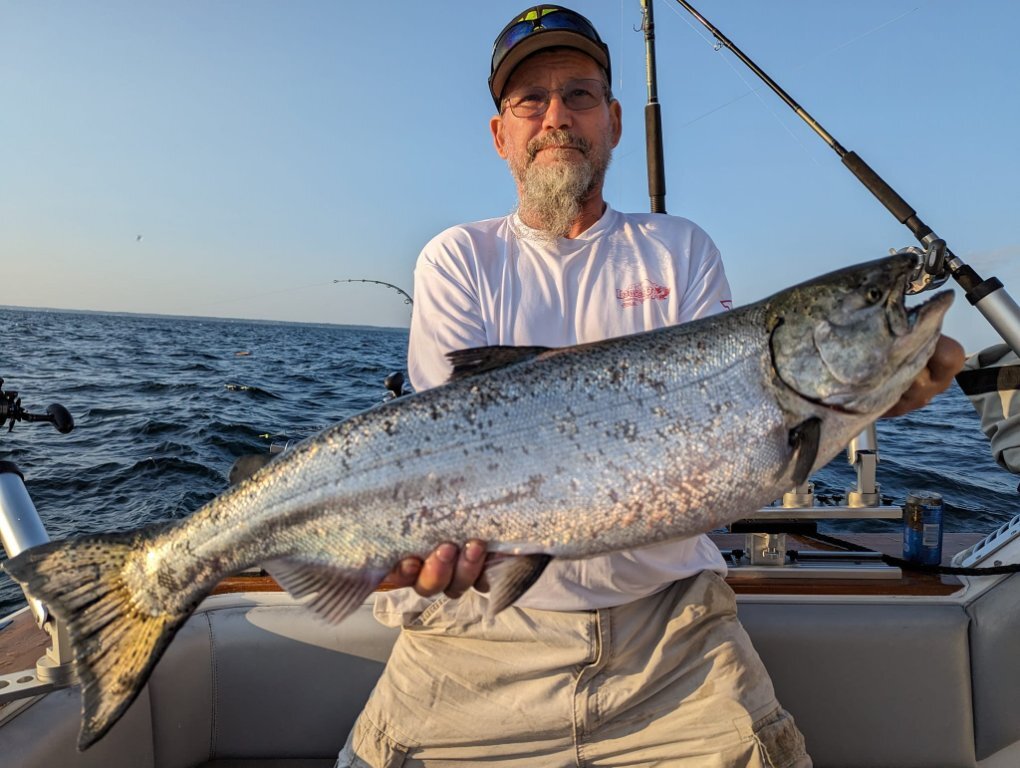
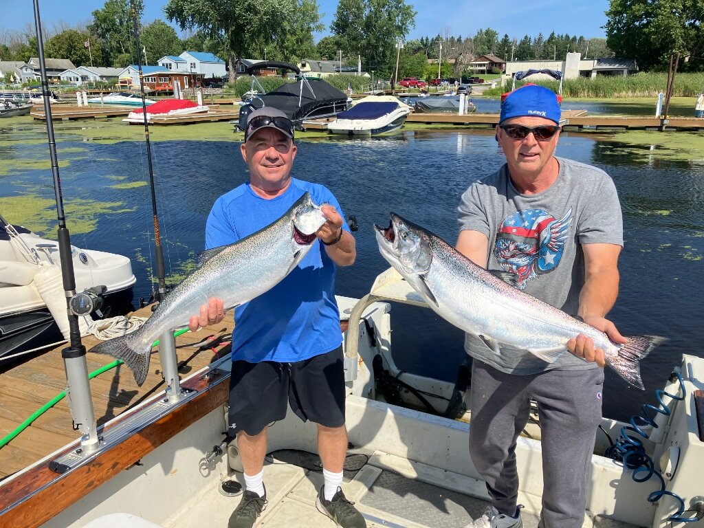
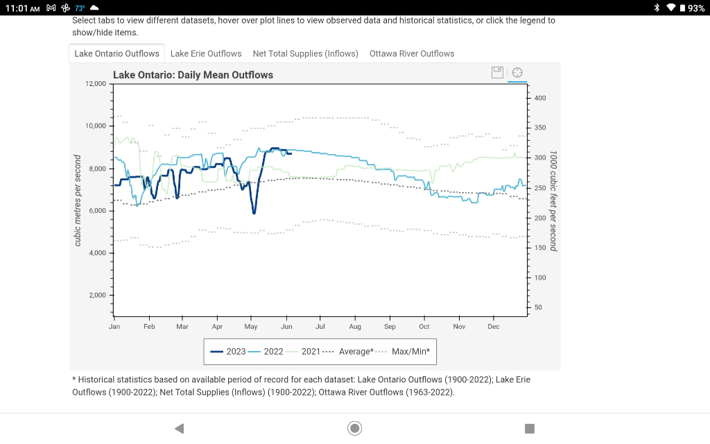
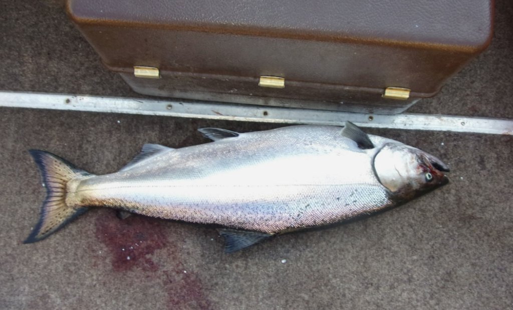 Day after a cold front...Perfectly clear sky...wind from the east, fishing is least... BULL FEATHERS! Launched solo at the river at 6. Took a left toward the ponds. Put in at 80 FOW. Lots (and I mean lots) of bait suspended in 93-95FOW. Worked about 90 to about 130FOW. Thinking there is a pretty good upwelling in the making this morning. At 2 3/4 downspeed (2.7 GPS) speed with 75 ft of cable out in 110FOW had 54F down but at same speed & cable out in 85 had 42F. Anyways, 3 shakers and 2 respectable. (14 & 22 Lbs) All on mupped rigger down 55, running purple spooks. All above temp & hitting freeking hard! (even the little ones made the reels take off) Bigger one wasn't all that long, but I don't think I've ever seen such a fatty! Thinking she was sniffing the creeks & ready to make the run real soon. Smaller one was still silver but just beginning to show brown towards the tail. Bigger one had a lampry mark, others all clean. I don't think the bigger one survived, even though I tried to resusitate it, as she had lost a bit of blood. All the others flipped me off and swam away. Off at 10:30 as the wind was picking up. Luck to all. Tom B. (LongLine)
 -
downriggers
-
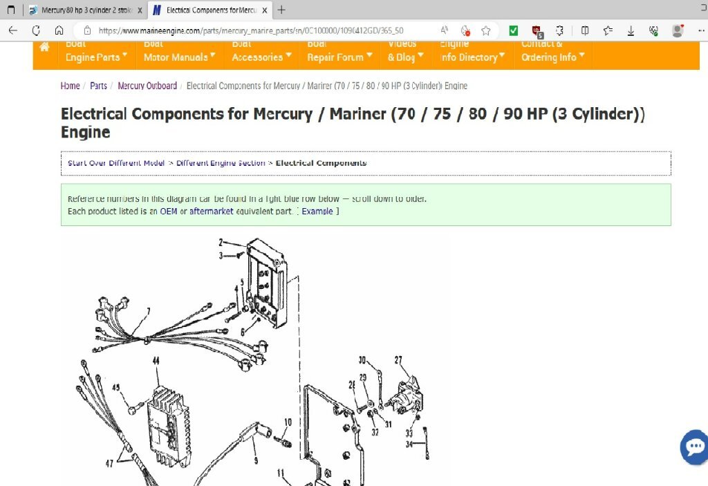 So I read that, that the "0" in front of the "A" isn't used in serial lookups. And the A752171 is the same as the 9549689 (Belgium) and C100000. (Does motor look like this?)
 -
I don't see any serials starting with "0A75". I don't know that mercury put the hp in the serial like Evinrude did. I know that many parts on the Evinrude 3 bangers are interchangeable over the hps.. (but not all.) Have you heard of the site: iboats.com? Under the tab entitled "community" they have a forum category for Mercury repair. I'd ask them for help on ID, troubleshooting & parts info. Some of those guys are very helpful.
-
On that site, you should be able to find a good drawing of your electrical system components. Mercury may not call it a 'control module." Might be called some kind of "switch."
-
I've bought parts from marinenegine.com. (Are you sure that's an 80 hp?) Your coil to control module wire and connection are good...right?
-
I read this as that you have an older engine with two issues. 1st being fuel in the engine well of the boat after you trailer it. The 2nd being that it won't come up to full RPM when under way. The 1st is that you have a leak some place in the fuel line or that the fuel line is not holding pressure. Check by disconnecting line from motor & pump the ball. Should get really hard and stay hard. (Obviously no smoking when you do this) On the 2nd: As long as you have good compression and good strong spark across all 3 cylinders then the issue must be with the fuel or fuel delivery system. I'm assuming you completely emptied the tank when you bought it. Sea Foam is good at dissolving "crap" in the tank; however, it will thin out any "sludge" (and may not dissolve all of it) which will get pumped into the motor. What I do every couple of years is pump out about a gallon of gas from my tank FROM the bottom. I made a simple pump by using a couple sections of hose and a fuel line ball between them and hand squeeze into a $7 clear cookie jar from walmart and look at it. (Is it possible that you filled up tank, put Sea Foam in it then ran it before doing any of the other stuff?) As you ran it on a separate tank but had the same low RPM issue, then the in-boat tank & fuel are eliminated while you ran it on the separate tank. (You also replaced those lines. Older lines were not ethanol resistant & did deteriorate) You also said you replaced fuel filter but didn't say what you found in the filter. This leaves the fuel pump, interconnecting fuel lines, carburetors, autochoke solenoid and the linkages between spark & carburetors. You replaced the interconnecting fuel lines & tightened them so they're eliminated. I'm thinking linkage is eliminated because engine was not hard to start, rang at idle and didn't run rough up to 3300 RPM. (Although 800 RPM idle seems a little high to me). However, you can research "Lync & sync" on internet for your engine. Check conditions of any rollers on the linkages. i.e grooves or flat spots. If your fuel pump is weak, then next time you're out on the water, have someone pump the ball in the fuel line. If no difference then I'd think there's a very good chance that your pump is okay. (However, if it's the original pump, diaphragm might be thin, and I'd replace it for peace of mind.) You might also try the autochoke when you get to that speed. This leaves carburetors. Be careful removing them & observe if anything is in the bowls. I.e particles, sludge, etc. If original parts, float could be saturated (and not floating & out of adjustment) or spring & needles could be "sludged up." If you've gone this far, it'd probably be best to clean everything & get rebuild kits that include float, spring, needle & gaskets. If you found particles in the bowl, especially black ones, then something rubber has deteriorated, and you need to find the source. Electric start motors usually have an autochoke solenoid. When you have the engine off and activate the choke from the controls, you should hear a loud click from the solenoid. It has rubber o-rings in it. Pretty easy to remove and check for deterioration. Note" When you run the motor out of gas by disconnecting the fuel line, you should always wait a couple minutes then try to restart the motor fully choked to run gas out of it and its lines. Unfortunately, B.O.A.T equals "Break out another Thousand." Good luck & let us know how you make out.
-
Braddocks 8/6
LongLine replied to whaler1's topic in New York Fishing Reports - Lake Ontario (South Shore)
-
Did you replace the disconnect fitting? Older Mercs had that huge push & twist style "pain in the butt"fitting. They had a O-ringaround the ball inside & if it didn't seat right the dag-gone thing would leak.
-
Yes
-
Guessing that you tow with motor tilted up. Even though you run engine till it stalls with fuel disconnected, there is still some fuel in the carbs that could leak/pour out on the way home. (although you'd think it'd evaporate.) Check for good/consistent spark on all 3 cylinders before you pull carbs.
-
Check the small hoses and fittings between the fuel pump and the carburators. They may be cracked, deterioated or loose. If in great condition then go after carburtors. You're leaking fuel & sucking air someplace.
-
When I stack, I put a spoon on the bottom about 20 ft back. Flasher/dodger is 8-10 ft higher and only 7-10 ft back. Trick is to let it down SLOWLY. Flashers/dodgers will not go down as fast as clean spoons.
-
 They won't survive if you don't. (sorry but wiseguy in me) Hold their heads in the direction of your troll for a few minutes to try to resusitate them, then push them downward. Many do survive this way.
 -
 IMO, If you can see the other guys net up in the air like that, you're too close! Similarly, there should be a law against Autopilots as some guys turn them on & don't pay any attention to where they're going especially when they're cruising out to the fishing grounds. I've been nearly run over numerous times by cruisers
 -
I don't have a Panther. but I learned a long time ago to ALWAYS CHAIN the motor to a tow ring or heavy cleat on the boat.
-
Is there a side cover on cylinders, on one side? i.e a water jacket cover. Removing it may allow you to at least see in there.
-
 Way back when...a radio study was conducted that concluded they don't go very far: Seasonal Movements and Habitats of Brown Trout (Salmo Trutta) in Southcentral Lake Ontario - ScienceDirect Of course this was before the gobies.
 -
-
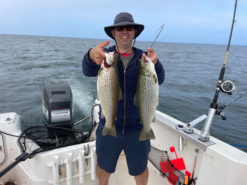
Braddocks 6/9
LongLine replied to whaler1's topic in New York Fishing Reports - Lake Ontario (South Shore)
 WTG!
WTG! -
 WTG!
WTG! -
Downrigger Backlash
LongLine replied to Just1skipper2's topic in Questions About Trout & Salmon Trolling?
Stuff already mentioned does affect blowback however there are a couple other variables. (!) size of your cable. 200 Lb has much more blowback than 150Lb wire. (2) coated cable has more blowback than uncoated (3) shape of your weight. Cannonballs have more blowback than torpedo or fish shaped weights. (4) hardware you're running. Probes will require at least 2 Lbs more to achieve the depth you want. Flashers & pinchpads will have a slight effect also. -
 Well that's a load off your mind...Compression difference is real bad...definitely a rebuild. rings, head, etc. or someone bought for parts. (cuz they expensive) Good luck with finding a new one. Let us know what you get.