

LongLine
-
Posts
4,171 -
Joined
-
Last visited
Content Type
Profiles
Forums
Events
Gallery
Store
Everything posted by LongLine
-
Also use cable. No reason to chamge.
-
 WTG Rich! You got the big boat in?
 -
 I'll be sitting on my back porch & should get a perfect view as neighbor cut down that tree. There's no way I'd go to a park or be on the water. People are generally nuts during the full moon so I can't imagine what they'll be like during a total eclipse! If cloudy, which Rochester generally is, it should go totally dark. Will be interesting to see if the street/expressway lights come on.
 -
If you've filled the boat and have drips coming out of the end of a runner, then it sounds like a hole under the runner. I'd pull the floorboards and check that area really well.
-
3 rod brown trout set up
LongLine replied to greenhornet73's topic in Questions About Trout & Salmon Trolling?
When fishing solo, size of boat and how you control/steer your boat is a factor. Can you lock your wheel? Auto pilot? A single planner to one side will tend to turn your boat in that direction. -
Steering is the biggest problem when going solo. I assume you have a smaller boat with manual steering. Only using 1 planner and to a smaller extent, one dipsey will pull you boat to that side. Best to run a pair to balance things out. Going solo 99% of the time I used 2 riggers most of time.
-
Years ago, I had a 21 ft PennYann that weighed roughly 4K Lbs on a tandem axle roller trailer. I was dumb enough to go fishing at the river in early November. (River ramp real steep with shallow water) I had a steel cable on the winch. Upon retrieval, I got it roughly 3/4 of the way on the trailer and the cable snapped. Pulled bow line right out of my hand. Boat went back out in the river about 25 ft from end of dock. Nobody else around so had to take the winter suit/boots off and go swimming. Colder than all get out! Got rid of that beast the following year. (for other reasons) My current smaller boat (18 ft;r) has a trailer that is half roller & half bunk. (Rollers on keel & at transom) It's never been a problem launching or retrieving.
-
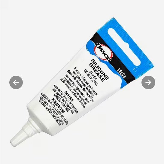 I just replaced a keel roller, but it had a metal tube insert. Used marine axle grease on installation. 1st one lasted over 37 yrs with not add' greasing.
 -
 Thanx Rich. Must be fun keeping the clients straight, much less the lines. Good luck out there. High probability of good weather.
 -
Hey Rich - 2 questions" 1st: 2 each board, 2 plain dipsies, 1 each rigger, 2 lead, 1 copper. How'd you run more? (a kite?) 2nd: Ever have 12 fish on at a time?
-
Funny how some want govt vehemently out of their lives and yet so quickly change their tune when things aren't going their way. Yes, ecosystem is fragile. Mussels changed things. Takes years to recover, but recovery is happening. Areas of Concern are being cleaned up. Polution laws have gotten stricter. (no thanks to a certain political party) Bass are getting larger. Alewives seem to be coming back. Sturgeon are coming back. Hatcheries are getting more than enough eggs. Natural Repro is occuring. Bass tournaments have grown but weigh ins are more and more requiring live weigh ins. (Most Bass boats have live wells. ) If enough aren't "plucked out", the result is stunted fish. Problem I see is that not enough guys report violations that they witness.
-
Just wait till Artificial Intelligence is introduced to fishing, if it's not already there.
-
Going out Saturday, newbie on Lake O has couple questions
LongLine replied to moonfish's topic in Tackle and Techniques
 yes, water will be stained. Genny has been flowing pretty well. MODIS shows more color to west than east.
 -
"Fishing" can be defined as "the activity of trying to catch fish." I don't know anyone who thinks these inventions within the last 70 years make our fishing "unsporting": Electric downriggers Ball bearing swivels Fiberglass/graphite/combo rods Dipsy Divers Multiple gain, color screen fish finders with alarms Electronic temperature probes Floro & Copoly fishing lines GPS with waypoint memory Line counting reels Lead core/copper lines Contour following electronics Internet fishing websites How many ran right out & bought them? None of them actually put fish in the boat, however, they were pretty progressive for their times, and most are commonplace today. IMO, anyone against trying to make progress is stuck in their "horse & buggy" days. Doesn't matter to me how you fish (as long as it's legal), so enjoy it while you can.
-
Trolling with gas outboard motor question
LongLine replied to jake8484's topic in Questions About Trout & Salmon Trolling?
Sorry, but I'm leery of lowering rpms. Police cars aren't necessarily normal stock cars. If my Ranger idles too long, the engine will automatically increase rpms. I'm guessing some kind of heat control. Lord knows what newer electronics will do. (Make sure you're pumping sufficient water at lower rpm.) I used to have a merc 9.8 that would go as soon as it started. I'd swear that the 2022 9.9 that I have now is cold blooded. It has to run choked for 3-4 minutes to warm up before it'll run. (even with throttle control depressed, doesn't seem to significantly change warm up time). However, when warmed up it'll troll my 18 ft'r down to where I can troll X4 flatfish. (0.8 mph on GPS.) -
Trolling with gas outboard motor question
LongLine replied to jake8484's topic in Questions About Trout & Salmon Trolling?
Motors are spec'd to run at certain RPMs by manufacturer. A four stroke may not get the oil it needs if you go below what's spec'd. Bags & plates are much cheaper than new motors. -
Discussion was about ANGLING as OP said "on the boat". I suppose some might use a boat while ice fishing, but I don't know any. (hopefully.) I've seen cars, trucks, snowmobiles on the ice but never a boat. A guy once claimed he trolled on the ice and caught 200 Lbs of ice, but I never believed him. DEC explicitly states ice fishing is not ANGLING. (my caps) I troll 3 rods all the time from my boat. (In the open water, never on ice) Very easy to do without tangles, if you know how. I had a triple once, off two riggers (a major, a teenager and a bow) and nothing tangled plus all successfully released, while solo. I've had numerous doubles out there solo, also with no tangles. (hopefully, I'm not jinxing myself) With 2 on the boat, we only run 5, with 3 in same configuration as solo.
-
Semantics can be argued all day long. I read the wording "and includes" to mean requires. Yes, I realize you can land a bass via thumb in mouth (if you don't mind hooks in your fingers)'and you can tail a King.; (If you don't mind getting splashed.) and you can drag a fish to shore then scoop it out with your hands. With those in mind and the advent of the Boga type grip, maybe this reg should be re-written/clarified. Use and possession of Gaff and Gaff hooks is explicitly prohibited on fresh water in New York State, in the general angling regulations. Maybe regs say you can use them with tip-ups/downs somewhere, but I'm not aware of it. Tip-ups/downs are not considered angling. I've seen those 2nd mortgage boats too. $100K for the boat $45K for the power plant $50K for electronics $15K in rods/gear $85K for the truck to haul it all $2K for insurance for what? One has to win a lot of tournaments to pay that back. With old age comes wisdom and sometimes senility.
-
Creel limit is how many a fisherman can keep. Not how many a fisherman can catch. (Which opens the door to many questions)
-
There is NO LIMIT on RODS. The limit is on LINES. The reason it is on lines is simply because you do not need a rod to catch a fish in New York State. Growing up on Port Bay, our neighbor's grandfather (from the "old county") used to sit on his dock with a hand line. I can remember him hand-lining a Northern Pike in! (was amazing) There's also a thing called the Seth Green rig, where a real Seth Green uses a winch to reel in a weighted cable with multiple hooks attached to it. (A slider attaches to your fishing line, not the downrigger cable.) The hook and point rules (quantity and size) are there for multiple Alabama rigs (umbrella) and gang hook snagging or foul hooking (incidental or not) Also, if you read the DEC definitions of "angling", it requires the use of a net to complete the landing of the fish. Tip-ups are explicitly classified as not angling in the definitions which is why they have different regs. What we call the "3 rod rule" was initiated and lobbied for by Big-O recreational fishermen to help them catch Salmon and was supported by many charters. (I know because I initiated the petitions) The logic behind it was simply that Great Lakes fish could be above, in, or below the thermocline at any given time which was difficult to cover at the time with only 2 rods while trolling unless you had multiple persons on board. It was felt that the 3rd rod could help more fishermen be successful hence more guys would return to the fishery and word would spread throughout the countryside. which could entice others. The bottom line being potential for more license sales and help promote Big-0 fishing which would benefit local communities. i.e. bait shops, motels, launches, camp sites, gas stations, restaurants and even charters, etc. Tom B. (LongLine)
-
Yankee in the ROC 12/31
LongLine replied to Yankee Troller's topic in New York Fishing Reports - Lake Ontario (South Shore)
 You the man Rich! Happy New Year!
 -
Lake Ontario water temps - Deep water off Rochester
LongLine replied to GAMBLER's topic in Open Lake Discussion
 Hoping for a mild spring, but according to the glerl.noaa site, bottom temps & transects are not uniform. There's a lot of awful cold water out there beyond that warm patch along the south shore.
 -
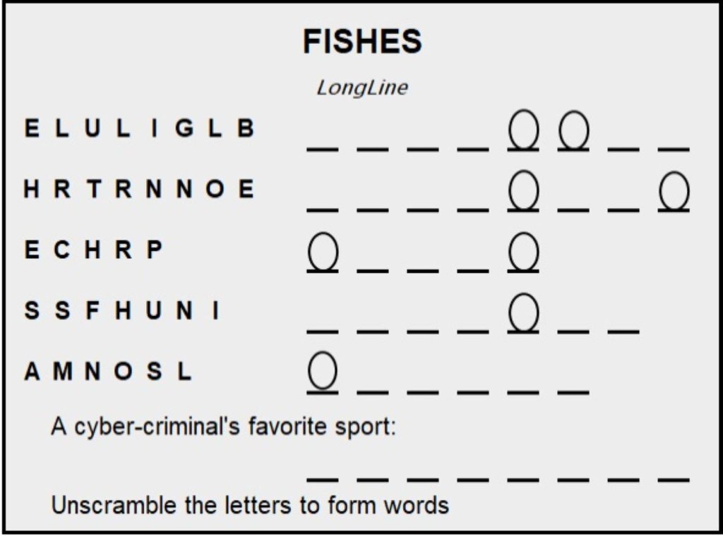 Here's an easy one. Happy New Year!
 -
 The fish have seemed to forget how to eat my lures!
 -
Only liars have never experienced this. GO BILLs !!


