LongLine
-
Posts
4,171 -
Joined
-
Last visited
Content Type
Profiles
Forums
Events
Gallery
Store
Everything posted by LongLine
-
Special experiences on the water while fishing
LongLine replied to rolmops's topic in Open Lake Discussion
 Once had a couple big orange butterflies land on a rigger rod out in 150 FOW. They stayed for about 10 minutes and then took off. About 20-30 ft away from boat a bird swooped down and grabbed one of them. The other flew back to boat and stayed on dash next to side window for about 2 hours. Guess he felt safe there. Years ago, was E-W trolling in about 30-35FOW in front of river. Heavy fog set in and could just make out pierheads. Was startled by the foghorn. Then heard a loud engine rumbling and remembered there was no foghorn. Freeking concrete boat headed right for me. Gunned the motor, rigger wire snapped but I got out of its way quick. It past about 200 ft behind me and looked like a ghost ship. Scared the "S" out of me so I don't go out if fog is in the forecast. Also, years ago, while fishing off my dad's dock at Port Bay, saw a pike come up to surface - tail first. His head was probably halfway down another pike's mouth. Funny because neither one of them was all that big.
 -
Well, here's the answers so far: Safeguarding the Lake: Research Laboratory Monitoring Depths Surveys Plankton Lake Guardian Fishing related Across Down 1. Hook 2. Treble 2. Troll 4. Limit 3. License 5. Holder 7. Dock 6. Sinker 10. Release 8. Box 12. Ring 9. Stringer 15. Flasher 11. Cast 16. Rod 12. Rigger 17. Dodger 13. Swivel 18. Dipsey 14. Line 19. Sonar 21. Paddle 20. Shore Know where the fish come from? Vanhornsville Randolf Catskill Rome Oneida Salmon River More puzzles to come
-
 well.....I said it was an easy one. Did you get the crossword?
 -
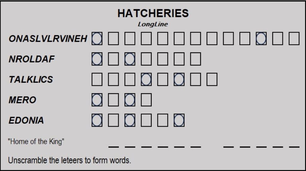
Here's an easy one. Know our hatcheries?
-
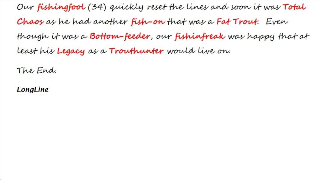
 Something to do while waiting for football & turkey. (all Big-O fishing related) Happy Thanksgiving to all.
 -
This makes me angry
LongLine replied to minnowcatcher's topic in New York Fishing Reports - Lake Ontario (South Shore)
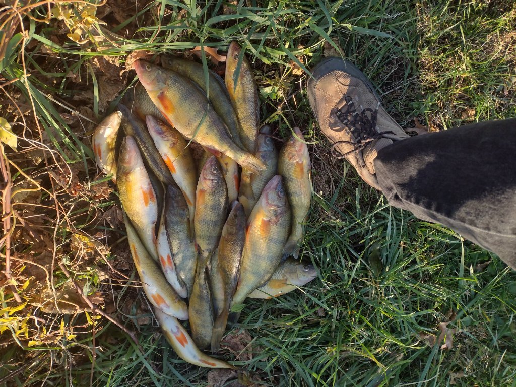 He may also have turned around and saw an ECO and realized he didn't have a license. Dirty shame cuz those are some nice perch.
 -
I would assume processed means filets. But to be sure, you should email the NYSDEC for clarification. They may want the skin left on for identification. Also, I would contact Canadian Customs to see what they allow back over the border. They may have special regulations for bringing "food' into Canada.
-
from the NYS regs" Fish caught in New York State Salable fish may be transported in any number. No more than two days' legal take of non-salable fish may be transported unless a permit is obtained from a DEC Regional Office, or the fish are frozen, processed, and packaged for storage. Not sure what the Canadian import regs say.
-
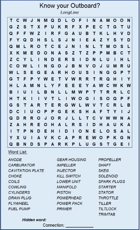 How well do you know outboards? Can you find all the parts? Enjoy.
 -
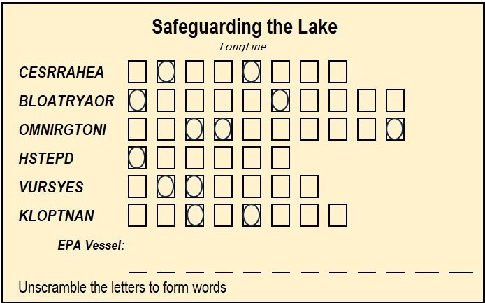 Safeguarding our Big-O Enjoy.
 -
Congrats on the boat. Thanx for the input.
-
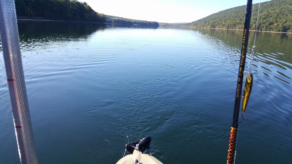
Thinking back on this summer season, I'm thinking fleas weren't as bad as they were years ago. (I only use 15 Lb copoly line). There still there but I don't remember having lines fouled anything like they used to, especially in the 100-200 FOW range. How was your experience this year?
-
Officials begin lowering Lake Ontario, St. Lawrence River
LongLine replied to salmoseine's topic in Open Lake Discussion
Corps shows a 0.6 meter drop at Rochester from 1 Oct to 29 Oct. Drop at Coburg 0.5 meter for same time period. Outflow of St Lawrence is 266,600 cfs which is lowest since May. Has there been a strong East or North wind? How has the precipitation been in the Ottawa River Basin this year? That's the main driver of Big-O water level. All that precipitation farther than 10 miles south of Big-O southern shore drains south towards the Chesapeake. -
What Size Trout and Salmon are considered Trophy
LongLine replied to Big fat pike's topic in Open Lake Discussion
Never read a copy of Field & stream huh? No question it's awesome. Too bad that some people don't want to maintain the awesome-ness we have. -
 It's not a matter of whether they've seen it. They obviously know about it as the graphs I've posted are from the annual reports. The question is whether they know that stakeholders have concerns about it. As well as If and what can be done about it? Is anything being done? People called about the alewife issue back in the 60's and salmon were introduced. After a few years the salmon demonstrated a very good economic return, and it became a world class fishery that attracted fishermen from all over the country. (The 1st ESLO derby only had a few salmon turned in and a 6 Lb'r won the Rev Modish a 14 ft boat. Thereafter the fishery grew.) M.N. introduced the diseases but aqua culturists developed the treatments.as a preventive maintenance to protect the fishery. M.N. brought in the Lampreys, biochemists developed the lampricides, also as preventive maintenance. Man polluted the lake and agencies are trying to clean it up as preventive maintenance. If M.N. had her way, it'd be a glaciated lake like it was created by M.N. at the end of the last ice age. i.e. pure water...no living organism in it. I look at it as a preventive maintenance item. I'm a C&R Rec fisherman and I'd prefer they discuss and look into the issue at their monthly meeting rather than have them say: "well, nobody's expressed any concerns, so the stakeholders must be fat dumb & happy with the direction things are going in."
 -
What Size Trout and Salmon are considered Trophy
LongLine replied to Big fat pike's topic in Open Lake Discussion
Numbers may be a little off in our minds but that's what the state currently recognizes. While they might raise some categories, I doubt they'll lower any as Big-O is promoted as a "World Class Fishery." -
Ring, ring, ring Hello, this is DEC, your call may be recorded for quaility assurance, please wait for next available officer. DEC officer 1: Hello this is DEC officer 1, how can I help you? Caller: I'm very concerned about decreasing size of fish in Lake Ontario. DEC #1: Well, sir, as you know the Lake Ontario Fishery is important to NYS, and DEC continues to support that World Class Fishery. Have a nice day. Click. DEC #1 turning to to DEC supervisor: Hey you know, that was the 157th call we got concerning the fish in Lake Ontario. At headquarters monthly DEC meeting: Quality assurance operator to DEC boss: We've got a lot of calls about fish in Lake Ontario. DEC boss to DEC suppervisor: What's going on out there? Supervisor to boss: Well, there's some concern about the size of the fish out there. Boss to supervisor: That fishery is economically important to the State. We've changed creel limits; we've cut stocking; we're treating them for disease; we've greatly reduced phosphates and chemical pollution; we're stocking ciscos; we've improved hatchery conditions. We should look into it. Get our partners involved. (USGS, USFWS, OMNR, etc) Explain what's going on to our stakehoders and at least explain current and future programs that may affect the concerns. (All starts with some stakeholder input.)
-
What Size Trout and Salmon are considered Trophy
LongLine replied to Big fat pike's topic in Open Lake Discussion
In order to qualify for the NYSDEC Angler achievement award, Kings have to be 33 Lbs. Cohos - 16 Lbs https://www.dec.ny.gov/outdoor/103336.html -
Thanx Brian (Gambler) and Brian (schreckstoff) Very interesting reads. (BTW what is a "schreckstoff"?) Points that stuck out to me in the nature article: - All the pacific salmon have been experiencing it but to different degrees (They talk length not weight and some fish I caught this year seemed to be "girth-ier for their length than previous years.) - The length change over the years is not linear and that it occurs to different degrees in different areas of Alaska but there is a definite downward trend everywhere - That species are all younger when spawning. (Which is also happening on LO) - That the younger spawners have less eggs and there is less nutrient transfer. (which I take as less mass to decompose after spawning) - That there is no single driver to explain the King length decline. Ocean currents and surface temps are minor effects. - That they really didn't go into natural vs hatchery (What I think they refered to as "net pen") - That size has a large economic impact on Alaska I know that it took 510 Kings to get the 2.4 million eggs this year, but don't know how many fish it took to get previous years egg quotas. Anybody have those figures? Apparently, it's happening to Atlantic's in Europe too. I found these articles based on University of Helsinki research, (Which I think Morgan mentioned a few years ago) www.sciencedaily.com/releases/2018/11/181114104356.htm www.helsinki.fi/en/news/climate-change/salmon-are-shrinking-and-it-shows-their-genes https://phys.org/news/2022-02-wild-salmon-smaller-linked-aquaculture.html One identifies a growth gene. One suggests food source lacking Omega (something) in their diet. One said it's evolutionary as they'll die out if they don't spawn early. Nothing I've seen directly says small parents produce small offspring, but we can assume that's generally true based on human & animal husbandry. Altogether, as we have a single strain of Kings, I'm wondering about the feed and disease treatment chemicals at the hatchery. Not sure when disease treatment started. Are disease resistant fish smaller? I know there was a feed change years ago and the DEC staff had to scramble to correct it. Could something be added to the feed? (Fish doctors won't like that.)
-
 I've had relatives get it, along with hips. Have the surgery, get epoxied back together; bedrest for a day then get kicked out of bed and PT for a couple weeks or so. Only downside is that you'll be advised to give up pole vaulting.
 -
Yes, I have faith in the scientific research also (as I studied Physics in college.) I realize that the lake has changed quite a bit since I walked through and smelled piles of alewives on the shores. I'm grateful for the fishery we have. HOWEVER, I would like a scientific explanation on why the graph I previously posted on the 4th page of this thread (which shows a big time downward trend in salmon weights starting at around 2002-2004) and this one, which definitely does NOT SHOW ANY downward trend in alewife population starting at the same time. (Even with a couple year lapse) All of which are published graphs. Looks kind of inconsistent to me. One could argue that the alewives were smaller, but above graphs show there were a lot more of them. Generally, when portions are smaller, "eating machines" go back for second helpings. Why don't/haven't they? They have a quota of how many they can eat a day? Food is/has been there. As density is up, it's not like they couldn't find food. Previously posted data showed 3 yr olds gaining only a couple pounds over the summer. Why weren't they bigger going into that 3rd year? i.e. 2 yr olds had to be smaller than pre-2004. Why...something stump their growth from YOY to 2 yrs? I hope things get better but when policy makers don't get stakeholder input, they have to assume the stakeholders are really happy with the directions things are going in and move on. Wait and see...who knows, maybe we'll get Sabre Tooth Tigers back.
-
Glad you got the boat all fixed up. A well running boat makes the fishing trips much more enjoyable. Sorry to hear you got cut off. I've had that happen when there were only 3 boats out there. Some guys are just "clowns." The Lake Unit doesn't work for the hatchery and the hatchery doesn't work for the Lake Unit. They communicate but both work for the policy makers at the Dept of Fisheries. The policy makers set the regs with input from all the regional groups, including stakeholders and others. The policy makers set the budgets. The regional groups have to submit requests for new pumps, personnel and whatever and hope they get approval. Each of the regional groups has to "fight" for funds. While not elected, the policy makers are political appointments. The policy makers have to review the annual report before publishing, which BTW where the heck is it???? I really appreciate Brian linking the prey fish assessment this year. The policy makers decided to go full bore on the Atlantic program even though the science has shown they won't survive. Why? Were the "trib guys" were pushing it? Why the Laker program? Because the Feds were pushing it? Why the Sturgeon? As I've said before: The policy makers want stakeholder input. Every time there is a policy/regulation proposal emails are sent out from DEC asking for input along with comment periods. Some guys just want to sit back and make fun of it, and I guess that's their prerogative as there are not only "clowns" on the water but also on the keyboard. I agree with Yank on this one. I'd like to hear what they've been doing as well as what they've planning to do about the size issue. How are their upcoming lake projects going to affect the salmon? Are we just shrugging our shoulders and saying, "live with it?" "Clowns" are funny, aren't they?
-
ifishy - The lake is a big place and crowds follow where the big ones are being caught. That's why the majority of guys who report great catches don't reveal exactly where they are. They know others will flock there the next day to catch "their" fish. The same goes for not naming small tribs. Fishing pressure will increase the next day. Word travels fast. Fishermen readily post smiling faces with their catches but very few post pictures of the sunrise or scenery of their outing. I-Bay has a great launch site now, but when I was there, the great majority of fishermen launches were fishing the bay, not the lake. I'm sure the same happens at other embayments. Here's some interesting tidbits from the '23 LOC - Salmon Div.. Spring: 8 of 21 prize winners were from out of state. All prize winners reported their fish from the west. The minimum weight for entry was 20 Lbs and 10 prize winners were under 21 Lbs. Summer: 6 of 21 were out of staters. 9 of 21 at the west end. 10 from east end. Fall: 6 of 21 were out of staters. 16 at east end, 4 west end. Minimum weight 25 Lbs with 8 prizes under 27 Lbs. What was the winner? Point being Fishermen follow the great catches. (Especially the tourists) Salmon are supposed to be "eating machines" especially before spawning, yet for over 30 years the average weight gain for 3 yr olds from July thru Sept has only been a couple of pounds. (30+ Lb'rs were caught in the 90's.) Safe bet that 2 yr olds pre-2004 were a lot bigger than 2 yr olds post 2004. When did we lose those two year classes of alewife? HB - A call to the DEC will express concern about the fishery. As I stated before "Policy makers will do nothing unless 'someone' benefits." DEC values and asks for stakeholder inputs. Opinions should be expressed now as DEC is putting their plans together for next year. I think the fishermen should be that "someone." West coast eggs won't help. I was out there a few years ago and caught basically what we call shakers. The guide's eyes bugged out when I told him we had 25-30 Lb fish. Besides, their fishery was in trouble this year & last as the Salmon seasons were cut short and cancelled out there. BFP- Unfortunately, gobies are bottom dwellers, Salmon are pelagic. i.e. wanderers that don't eat off the bottom.
-
Policy makers don't do anything without proof of a benefit to "someone." I love problems that solve themselves, unfortunately I've never seen one do it. Optimistic P-R certainly won't tackle one that's 1st showed up 20 yrs ago. Tourists come here to "catch" a trophy. If they do, they'll return. If they don't, they won't brag about it to their friends nor return. How many posts were there this year that included pictures of "little ones?" The DEC always asks for stakeholder input, but the number of respondents is always much less than the number of people who will be affected. This issue has economic impact as well as affecting the "quality of fishing" in NYS. I've been fishing Big-O & embayments longer than most members on this board have been born. I love being out on the water, away from the phone, keyboard and neighborhood. Unfortunately, I've seen Walleyes and Northerns become sparse in the embayments as well as seen Smallmouth limits in the lake become a rarity. I've seen catch rates on the lake go up, but angler effort go down, (Which tells me that guys who are good at it do very well, but those that don't, don't come back.) I used to see summertime boat launch parking lots packed with fishermen and I certainly didn't see that this year or last. Just a few years ago, I'd see 25-30 boats out there in the summer. (A lot of them smaller than me) This last summer, I saw maybe 6, at most. (All of which were much bigger than me.) In the "old days", I've seen hundreds. Point being: If you care about the Salmon fishing in Big-O, let the DEC know. BTW, Minimum weight for spring LOC is 20 Lbs. This year's 20th place went to a 20.07Lb'r. If the trend continues, there won't be a 20th place finisher in the next.