


rolmops
-
Posts
4,824 -
Joined
-
Last visited
Content Type
Profiles
Forums
Events
Gallery
Store
Everything posted by rolmops
-
Sandy Jig 8/14 and 8/15
rolmops replied to idn713's topic in New York Fishing Reports - Lake Ontario (South Shore)
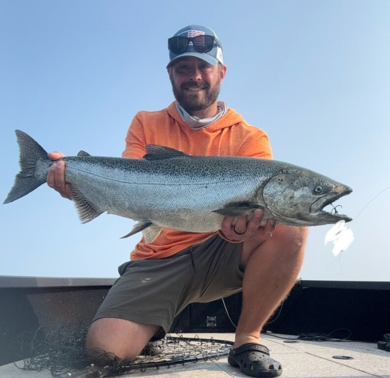 On Tuesday I went out of Sandy and over 300 feet the water was 72 degrees 135 foot down. I caught steelhead at 120 feet down. So on Tuesday I went out of Oswego expecting a different picture. Out there the thermocline was at 135 feet in 400 feet of water.as we were moving farther north east to roughly 500 feet the thermocline came up to 110 feet. It felt weird.
 -
Sold / Closed 1983 Sylvan Offshore Aluminum Fishing Boat W/Trailer Has Brand New Motor $3,700.
rolmops replied to Captain Dave Tripiciano's topic in Boats for Sale
 So what is this very low price?
 -
Muddy creek has 2 sizes of boards. Small and Large. It is not clear to me if they are heavy wood or some artificial material which would be light. If they are lightweight, they will lay high in the water where they really should be deep in the water thereby creating more resistance. In order to make them pull harder, you should put like a pound or 2 of lead on the outer side board. This will make them run deeper and pull harder. The best solution would be a change to either Otter boats with single or double keels, or Amish boards which also pull very hard. As an alternative you can make your own boards. If you do that,use cedar and do not paint the wood because it would seal it, while you want the wood to soak up the water in order to lay deeper in the water
-
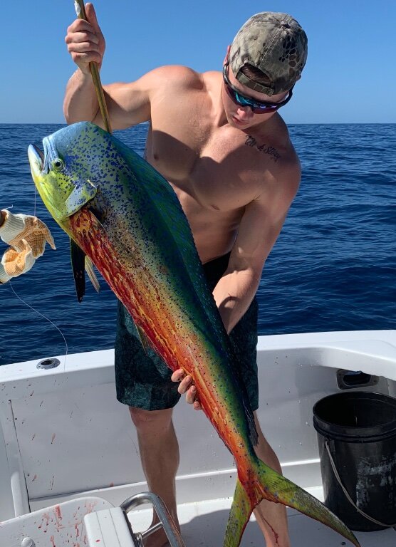 I have been going back and forth to a small peninsula on the pacific coast of Costa Rica and got to know some of the charter boat captains quite well. The cost of a week in Costa Rica including the flight, hotels, food and daily charters is less than half the price of a 4 day trip to the Carolinas. So for me It was an easy choice to make. The town I go to is called Mal Pais nearby a place called Santa Teresa. The place is popular amongst the surfing and yoga crowd in the late fall and winter season, but in September, October it is almost empty. The fishing is fantastic, the beach view is amazing, car rentals are cheap. so day trips to the nature reserves are easily done. I am wondering if some people would be interested in making that trip and have a nice fishing vacation. If anyone is , maybe we can get some small groups together say anywhere between 2 to 4 or 3 to 5 people on a boat. It is a great adventure for a very reasonable price. The return flight , including a flight on a Cessna puddle jumper, is altogether roughly $900 One 8 hour day offshore fishing would cost about $1100 and divided between 3 or 4 people that is cheap. Near shore is about $100 per hour, and I have caught Tuna and Mahi Mahi on these trips. You can keep the fish and cook it up or donate it to those less fortunate than us. ( I donate all my fish to a local orphanage which is run on donations) My best day off-shore so far is 23 Mahi-Mahi ,18 yellow fin tuna and 2 sailfish. For the first time in my life I have had to hand off my fishing rod to the mate because I was exhausted. The tuna is anywhere between 10 and 50 pounds, the Mahi Mahi are the 4 to 5 year olds usually about 4 feet long and close to 30 pounds Anyway, give it some thought and maybe we can get something together.
 -
-Copy.jpg.33de534a8f2d1d69ac9f1b783953818a.jpg) Yes it was fun, but I finally got my boat in tiptop shape just a week ago just to see my chances of using it dwindling way too fast. I will just have to get back to Costa Rica where the tuna and Mahimahi season is heating up.
Yes it was fun, but I finally got my boat in tiptop shape just a week ago just to see my chances of using it dwindling way too fast. I will just have to get back to Costa Rica where the tuna and Mahimahi season is heating up. -
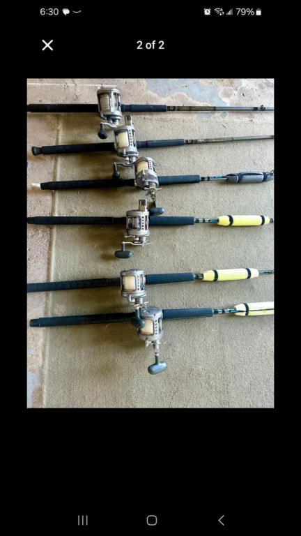 I'll keep my ears open. I have engraved my name on almost everything I carry on my boat.
 -
Sold / Closed Garmin Reactor 40 Kicker Pilot W/GHC20 Screen $1700
rolmops replied to Midriver's topic in Classifieds - Buy, Sell, Trade or Rent
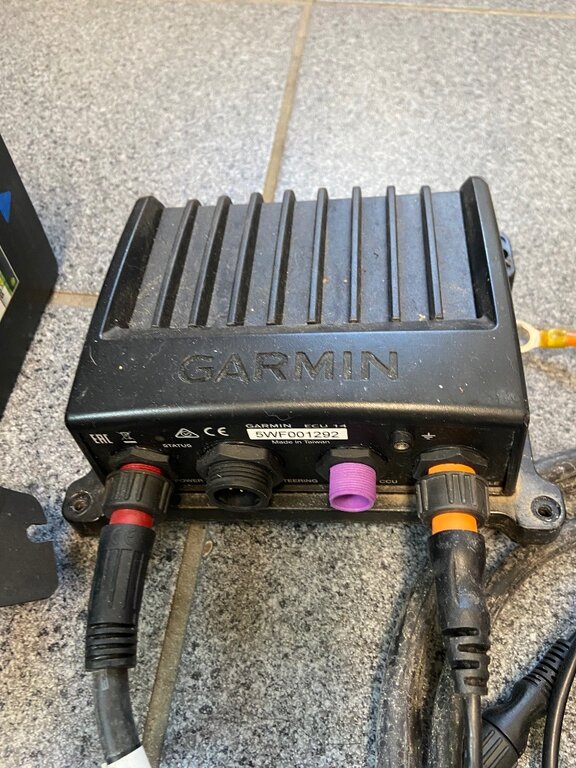 It has to do with the speed control connection not the contact point or the steering bar. If you try to attach it to a Tohatsu 9.9 tiller, the steering bar would be a problem because these tohatsu tillers do not have a steering bar setup (shaft tube). On a suzuki 9.9 you would have to buy an additional attachment for the speed controller connection. Also, This setup is really for Kickers, not for main engines. This setup works great. and it is a must have have for solo fishermen.
 -
Tips for oswego
rolmops replied to seeyawader's topic in New York Fishing Reports - Lake Ontario (South Shore)
I do not think that the fish actively go offshore. When the wind changes, it moves the body of water that these fish are in to another place. Like being in a car. You don't move inside the car, but the car moves you. Eastern and northern winds move these water bodies to different places than what the prevailing western winds do. Hence the temperature changes that often happen close to shore. But that mostly happens fairly close to shore. When you go far enough away from shore, These influences are much less important and the situation remains fairly constant and as such is much more predictable. Brown trout like to stay closer to their source river or creek and they will active swim back to where they feel "at home" As to how far you should go out, just go and usually when you see the thermocline come higher and stay constant you will start seeing baitfish and the salmon will be there. That could be at 400 feet or 600 feet. its mostly a quessing game with some pointers to help you along. If all else fails, follow the charter boats and the captains will do the guessing for you. -
Tips for oswego
rolmops replied to seeyawader's topic in New York Fishing Reports - Lake Ontario (South Shore)
One very important thing happened. A wave height /water temperature buoy about half a mile out of Oswego. While it always was a guessing game about wave height and wave period, Now there is on the spot real time info. So now, we can decide at home before we load up and go only to find out that the weather man was wrong about wave height.. This additional info source is great View the latest observations near Atlantic Potential Tropical Cyclone Four and East Pacific Hurricane Carlotta. Station 45215 - Oswego, NY (274) Information submitted by Scripps Institution of Oceanography Waverider Buoy 43.501 N 76.539 W (43°30'3" N 76°32'19" W) Air temp height: 0 m above site elevation Sea temp depth: 0.46 m below water line Water depth: 40 m Latest NWS Marine Forecast Search And Rescue (SAR) Data Meteorological Observations from Nearby Stations and Ships Map Type: Zoom in Zoom out CHS, Esri, GEBCO, Garmin, NaturalVue | CHS, Esri, GEBCO, Garmin, NGS Powered by Esri Large icon indicates selected station. Stations with recent data Stations with no data in last 8 hours (24 hours for tsunami stations) Disclaimer Refresh page every 10 minutes: Conditions at 45215 as of (12:56 pm EDT) 1656 GMT on 08/02/2024: Unit of Measure: Time Zone: Click on the graph icon in the table below to see a time series plot of the last five days of that observation. Wave Height (WVHT): 0.3 ft Average Period (APD): 2.3 sec Air Temperature (ATMP): 77.5 °F Water Temperature (WTMP): 77.2 °F Previous observations TIME (EDT) WDIR WSPD kts GST kts WVHT ft DPD sec APD sec MWD PRES in PTDY in ATMP °F WTMP °F DEWP °F SAL psu VIS nmi TIDE ft 2024-08-02 12:26 pm - - - - - - - - - 77.4 77.2 - - - - 2024-08-02 11:56 am - - - 0.3 - 2.5 - - - 76.8 77.2 - - - - 2024-08-02 11:26 am - - - - - - - - - 75.9 77.4 - - - - 2024-08-02 10:56 am - - - - - - - - - 75.9 77.0 - - - - 2024-08-02 09:56 am - - - 0.3 - 2.2 - - - 75.4 76.8 - - - - 2024-08-02 09:26 am - - - 0.3 - 2.3 - - - - 76.6 - - - - 2024-08-02 08:56 am - - - 0.3 - 2.3 - - - 75.2 76.3 - - - - 2024-08-02 08:26 am - - - 0.3 - 2.5 - - - 74.1 76.3 - - - - 2024-08-02 07:56 am - - - - - - - - - 74.1 76.3 - - - - 2024-08-02 07:26 am - - - - - - - - - 74.3 76.3 - - - - 2024-08-02 06:56 am - - - - - - - - - 73.9 76.3 - - - - 2024-08-02 06:26 am - - - - - - - - - 73.8 76.3 - - - - 2024-08-02 05:56 am - - - 0.7 - 2.2 - - - 73.6 76.3 - - - - 2024-08-02 05:26 am - - - - - - - - - 73.8 76.5 - - - - 2024-08-02 04:56 am - - - - - - - - - 74.1 76.6 - - - - 2024-08-02 04:26 am - - - 0.3 - 2.4 - - - 74.7 76.8 - - - - 2024-08-02 03:56 am - - - 0.3 - 2.4 - - - 74.5 77.0 - - - - 2024-08-02 03:26 am - - - 0.3 - 2.4 - - - 74.5 77.0 - - - - 2024-08-02 02:56 am - - - 0.3 - 2.4 - - - 75.6 77.2 - - - - 2024-08-02 02:26 am - - - 0.3 - 2.4 - - - 74.7 77.2 - - - - 2024-08-02 01:26 am - - - 0.3 - 2.5 - - - 74.8 77.4 - - - - 2024-08-02 12:56 am - - - 0.3 - 2.5 - - - 74.5 77.4 - - - - 2024-08-02 12:26 am - - - 0.3 - 2.6 - - - 74.8 77.4 - - - - 2024-08-01 11:26 pm - - - 0.3 - 2.6 - - - 76.5 77.5 - - - - 2024-08-01 10:56 pm - - - 0.3 - 2.7 - - - 76.1 77.5 - - - - 2024-08-01 09:56 pm - - - 0.3 - 2.7 - - - 76.5 77.7 - - - - 2024-08-01 09:26 pm - - - 0.3 - 2.7 - - - 76.8 77.9 - - - - 2024-08-01 08:56 pm - - - 0.7 - 2.6 - - - 77.2 78.1 - - - - 2024-08-01 08:26 pm - - - 0.7 - 2.6 - - - 77.5 78.4 - - - - 2024-08-01 07:56 pm - - - 0.7 - 2.6 - - - 78.1 78.6 - - - - 2024-08-01 07:26 pm - - - 0.7 - 2.7 - - - 78.4 79.0 - - - - 2024-08-01 06:56 pm - - - 0.7 - 2.7 - - - 78.8 79.2 - - - - 2024-08-01 06:26 pm - - - 0.7 - 2.7 - - - 79.2 79.3 - - - - 2024-08-01 05:56 pm - - - 0.7 - 2.6 - - - - 79.2 - - - - 2024-08-01 05:26 pm - - - 0.7 - 2.6 - - - - 78.8 - - - - 2024-08-01 04:56 pm - - - 0.7 - 2.6 - - - - 77.9 - - - - 2024-08-01 04:26 pm - - - 0.7 - 2.6 - - - 78.1 78.4 - - - - 2024-08-01 03:56 pm - - - 1.0 3 2.6 WSW - - 77.5 77.5 - - - - 2024-08-01 03:26 pm - - - 1.0 3 2.6 WSW - - 77.2 77.7 - - - - 2024-08-01 02:56 pm - - - 1.0 3 2.6 WSW - - 76.8 77.4 - - - - 2024-08-01 02:26 pm - - - 1.0 3 2.6 WSW - - 76.6 76.8 - - - - 2024-08-01 01:56 pm - - - 1.0 3 2.6 WSW - - 76.3 76.8 - - - - 2024-08-01 01:26 pm - - - 1.0 3 2.7 WSW - - 75.9 76.5 - - - - 2024-08-01 12:56 pm - - - 1.3 3 2.7 WSW - - 75.7 75.9 - - - - Detailed Wave Summary for 45215 as of (12:56 pm EDT) 1656 GMT on 08/02/2024: These wave data are displayed in rounded times. Unit of Measure: Time Zone: Click on the graph icon in the table below to see a time series plot of the last five days of that observation. Significant Wave Height (WVHT): 0.3 ft Swell Height (SwH): 0.0 ft Swell Period (SwP): 25.0 sec Swell Direction (SwD): SSE Wind Wave Height (WWH): 0.3 ft Wind Wave Period (WWP): 2.0 sec Wind Wave Direction (WWD): E Average Wave Period (APD): 2.3 sec Previous observations TIME (EDT) WVHT ft SwH ft SwP sec SwD WWH ft WWP sec WWD STEEPNESS APD sec 2024-08-02 11:56 am 0.3 0.0 22.2 WNW 0.3 2.1 SW N/A 2.5 2024-08-02 09:56 am 0.3 0.0 22.2 N 0.3 2.1 WNW N/A 2.2 2024-08-02 09:26 am 0.3 0.0 25.0 NW 0.3 2.2 WSW N/A 2.3 2024-08-02 08:56 am 0.3 0.0 25.0 WSW 0.3 2.2 SW N/A 2.3 2024-08-02 08:26 am 0.3 0.0 22.2 NNW 0.3 4.0 W N/A 2.5 2024-08-02 05:56 am 0.7 0.0 25.0 SSE 0.7 2.3 S N/A 2.2 2024-08-02 04:26 am 0.3 0.0 25.0 ESE 0.3 2.3 WNW N/A 2.4 2024-08-02 03:56 am 0.3 0.0 25.0 SE 0.3 2.2 WNW N/A 2.4 2024-08-02 03:26 am 0.3 0.0 28.6 E 0.3 2.3 WNW N/A 2.4 2024-08-02 02:56 am 0.3 0.0 25.0 SW 0.3 2.5 WNW N/A 2.4 2024-08-02 02:26 am 0.3 0.0 25.0 ENE 0.3 2.4 W N/A 2.4 2024-08-02 01:26 am 0.3 0.0 25.0 WNW 0.3 2.6 W N/A 2.5 2024-08-02 12:56 am 0.3 0.0 25.0 S 0.3 2.9 W N/A 2.5 2024-08-02 12:26 am 0.3 0.0 25.0 SW 0.3 2.9 W N/A 2.6 2024-08-01 11:26 pm 0.3 0.0 22.2 SW 0.3 2.9 W N/A 2.6 2024-08-01 10:56 pm 0.3 0.0 25.0 W 0.3 2.9 W N/A 2.7 2024-08-01 09:56 pm 0.3 0.0 22.2 W 0.3 2.9 WSW N/A 2.7 2024-08-01 09:26 pm 0.3 0.0 25.0 NNW 0.3 3.0 WSW N/A 2.7 2024-08-01 08:56 pm 0.3 0.0 25.0 WNW 0.3 2.9 WSW N/A 2.6 2024-08-01 08:26 pm 0.7 0.0 25.0 ESE 0.7 2.9 WSW N/A 2.6 2024-08-01 07:56 pm 0.3 0.0 25.0 NNW 0.3 2.6 WSW N/A 2.6 2024-08-01 07:26 pm 0.7 0.0 22.2 NW 0.7 2.9 W N/A 2.7 2024-08-01 06:56 pm 0.7 0.0 25.0 NNW 0.7 2.9 W N/A 2.7 2024-08-01 06:26 pm 0.7 0.0 28.6 SSE 0.7 2.9 WSW N/A 2.7 2024-08-01 05:56 pm 0.7 0.0 25.0 W 0.7 2.6 W N/A 2.6 2024-08-01 05:26 pm 0.7 0.0 20.0 WSW 0.7 3.0 WSW N/A 2.6 2024-08-01 04:56 pm 0.7 0.0 25.0 W 0.7 3.2 WSW N/A 2.6 2024-08-01 04:26 pm 0.7 0.0 25.0 WNW 0.7 3.0 W N/A 2.6 2024-08-01 03:56 pm 0.7 0.0 22.2 W 0.7 2.9 WSW N/A 2.6 2024-08-01 03:26 pm 1.0 0.0 22.2 W 1.0 2.9 WSW N/A 2.6 2024-08-01 02:56 pm 1.0 0.0 25.0 WSW 1.0 3.0 WSW N/A 2.6 2024-08-01 02:26 pm 1.0 0.0 28.6 W 1.0 3.1 WSW N/A 2.6 2024-08-01 01:56 pm 1.0 0.0 25.0 WSW 1.0 3.1 WSW N/A 2.6 2024-08-01 01:26 pm 1.0 0.0 25.0 WSW 1.0 3.2 WSW N/A 2.7 2024-08-01 12:56 pm 1.3 0.0 25.0 SW 1.3 3.1 WSW N/A 2.7 Plot of wave energy versus frequency (and period) Description of Measurements Links which are specific to this station are listed below: Real Time Data in tabular form for the last forty-five days. Historical Data & Climatic Summaries for quality controlled data for prior months and year . -
for sale : usa SOLD - 650-BRAND NEW Garmin ECHOMAP UHD 93 SV Touch Screen
rolmops replied to Beachit's topic in Classifieds - Buy, Sell, Trade or Rent
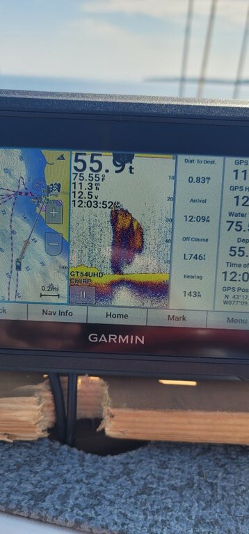 I like it , but for some reason Garmin stopped making them which will make it harder to get it serviced a few years from now, so yes $450 seems quite reasonable
 -
for sale : usa SOLD - 650-BRAND NEW Garmin ECHOMAP UHD 93 SV Touch Screen
rolmops replied to Beachit's topic in Classifieds - Buy, Sell, Trade or Rent
Does it have Great lakes maps? -
Mayers Marina owns a series of properties along the road and during the summer Bill used to direct the trailer owners to available spaces along the road. He just does not have the energy he once had and he no longer does that, but there usually are spaces open .
-
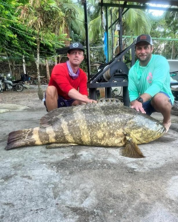 My fishing buddy from Mal Pais sent me a picture of his catch from his kayak in 20 feet of water. A giant grouper. He caused a bidding war between different restaurants and hotels. VIDEO-2024-01-15-21-00-07(1).mp4
- 1 reply
-
- 1
-

-
Thank you very much for your well thought out contribution to this thread. It shows how positive your thinking is and how deeply intelligent you obviously are. As for Allison and Bill, yes they are good people. I have been a friend of Bill for 25 years
-
Go shorter if you can. If you can get a hold of a some 7 foot rods you will be better of, specially on a kayak. Also you should think of jigging in a kayak instead of trolling. It is very easy to jig off a kayak and just as effective as trolling in many cases. A friend of mine caught a 150 pound goliath grouper in a kayak. He had to call s on his cell phone to come over and get that monster out of the water. VIDEO-2024-01-15-21-00-07(1).mp4
-
I think that the Irondequoit launch is in a class all by itself.
-
One of the causes (apart from a-holes) is the location of the entrance kiosk. It is right where the actual launches are situated, so every boat coming out of the entrance is right in the path of the launching boats. If the kiosk would have been at the very beginning of the entrance road with EZ-pass like photographic access and the entrance road would open onto the parking lot, people would drive through into the parking lot, prepare their boat for launch and then get in line for the launches, it would go a lot faster with less conflict. It still would not be idiot proof ,but less of a mess. On another note. How is the city launch at the Genesee River? Is it less of a mess or is it more of the same?
-
Escape Sandy Creek Shout and BFF
rolmops replied to GAMBLER's topic in New York Fishing Reports - Lake Ontario (South Shore)
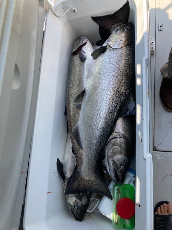 Congrats
 -
You will have to ask yourself a few questions such as was my boat out in the rain,or why is the water in the bow while usually the heaviest part of the boat is near the engine and water would normally travel that way. Or Where is my bilge pump, in the front or the rear? Do I have one or two bilge pumps. If the water only gathered in the front end ,does that mean that the boat is made so that water in the front cannot stream to the back? Do you test your bilge pump before you go on your way? Most boats have bilge pumps with float switches that kick in when the water level in the boat rises. Why did your float switch not turn the pump on? There may well be a loose rivet or seam that allows water in when the boat bounces in the waves. It happens a lot ,but those leaks only leak when the boat bounces around a bit. By the way, filling your boat with water while on the trailer can overload your trailer and tires to the point where you might damage your trailer
-
I sometimes use it during the week. It has a pay machine that accepts credit cards. The launch is fine and parking is free. If you want to go salmon fishing , you should be prepared to run a few miles to deep water. During the weekend it’s over crowded. If you launch a few miles farther west, you will be in deep water a lot faster. I live ten minutes away from Irondequoit launch, but I prefer to drive to Sandy Creek. Braddocks Bay has shallow water issues.
-
for sale : usa 2003 Sea Swirl Striper 2601 WA
rolmops replied to Millertime Sportfishing's topic in Boats for Sale
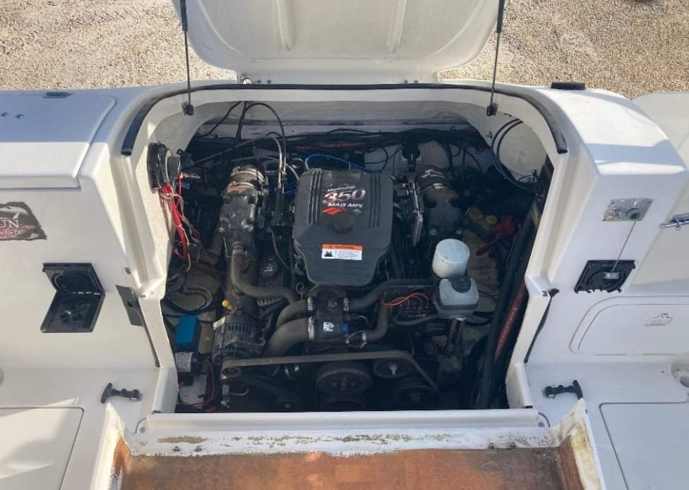 Climate change has changed Sodus Point
 -
This sounds weird, but it works. Lysol advanced power clinging gel, yes that stuff that is used for cleaning toillets. Squirt some on there spread it out with a cloth , let it do its thing and 10 minutes later you can wipe it off together with the tie marks
-
 Sometimes ignorant but dominant individuals willfully ignore the warning signs about maximum weight limits on the boat and other inconvenient messages because those things take away from what they perceive to be a great outing. I was seen as a spoiler of fun by grandma ( mother in law) because I would not allow my kids on her overloaded pontoon boat. About one hour later her pontoon capsized because a speedboat wake hit them. Luckily nobody was hurt, but grandma was in no mood to apologize.
 -
They were 2 very lucky campers, but I wonder if they had done a proper pre-check before launching.
-
One way to slow them down is by instead of flicking the swiitch. You can just loosen the wheel a bit and that way you can decide what speed to go with. Just don't forget to tighten them up when you reach your chosen depth.