Jump to content

Here it comes....


Recommended Posts

The cold water has been pushed against the northern shore, Coburg, Pt Hope & west areas (greens& yellows)with the entire south shore having warm water (oranges, reds). This map is predicting some cold water “springing upâ€

Link to comment
Share on other sites

Good explaination Tom. Thanks, it's nice to know how it compares to last year. Glad you're keeping track of it. Let's see what Aug. brings as far as fish caught compared to last year. Keep your fingers crossed. ;)

Link to comment
Share on other sites

I agree with ray, I think that this forecast is not plausible, forecasted wind direction and strength is not right for this to happen. Perhaps it is a history forecast rather than a conditions forecast.

Ray,

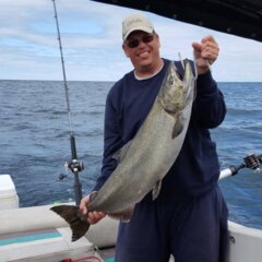
Did you know that there is a ridge off the NW corner of the Pt. Breeze breakwall where the bottom comes up 30-40 then back down again (in 500 FOW) this ridge cause bottom currents to push upward and becomes a structure magnet for the food chain. There was another 30+ king there today that succumbed to a MS Carbon -14. You need a chart or good chip in your gps plotter to find it. OR you can just look for the shine off my bald head!!

CC

Link to comment
Share on other sites

That's not the actual water temps, it's a forecast. Today is August 3rd and that is for August 4th. Here's what the actual water temps are like:

oswt-00.gif

Much warmer than what's forecast, although you can see the beginnings of the water movement. Like CBish said, that may be a historical forecast. Save yourself the long ride out to find that colder water off Sandy...it's not there....yet.

Link to comment
Share on other sites

Billy V – Yes it is a forecast. (as I stated & the map is dated 8/4) However you can see on the 6:00AM nowcast that you posted, there is a cooler water surface plume forming in that area and moving southward. (run the nowcast backwards i.e. 00, -03, -06, etc) Unfortunately, cold water shouldn’t hit the surface till we’re all back at work- Mond, Tues, Wed. :evil: Keep your fingers crossed by next weekend that we’ll have some cooler water on our shore. ;)

Ray – Don’t worry, I know you funning. Here’s the bathymetry of the area. Interesting structure to the S/SE/SW of it. It's very hard to find on the typical NOAA navigation charts. It's also interesting to see what the guys reporting on "attheoak" are fishing over when they're out at the 28, 29, 30 lines.

SCOTCHBONNETRIDGW.jpg

Tom B.

(LongLine)

Link to comment
Share on other sites

Create an account or sign in to comment

You need to be a member in order to leave a comment

Create an account

Sign up for a new account in our community. It's easy!

Register a new account

Sign in

Already have an account? Sign in here.

Sign In Now
×
×
  • Create New...